
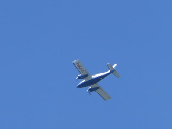
Aerial photograph taken by this light aircraft are to play a major role in planned rates reform in the island.
Many people have spotted the aeroplane passing up and down across the island over several days last week.
The plane is carrying out licensed mapping surveys for the Manx government.
These surveys are carried out annually with a full-island survey completed every three years.
.jpeg?width=209&height=140&crop=209:145,smart&quality=75)
.jpeg?width=209&height=140&crop=209:145,smart&quality=75)
They are used for planning, highways, the utilities and emergency services and provide an income for government.
But this year, at the request of Policy and Reform Minister Chris Thomas, the survey plane is flying lower in order to produce extremely high-resolution images of 4cm per pixel, that will ultimately be used for a new method of calculating domestic rates.
The proposal aims to bring greater fairness to the current rates system which dates back to the 1960s, with properties assessed on their rental value. Instead rateable values will be based on the area of a property.
The aerial photographs will be used to map out polygons of all homes in the island, producing an area in square metres. Tynwald backed the move in October last year.
The Ravenair Piper PA aircraft, being flown for Northern Ireland-based aerial imagery firm BKS Ltd, completed its survey of the low-lying and coastal areas of the island between Wednesday and Friday last week.
Mr Thomas said the images would allow ’us to begin the think about the next stage of the rates project’.