There was something for everyone in February, the latest statistics from the Met Office show.
Assistant scientific officer Gary Salisbury explained: After a relatively settled couple of months, the last third of winter saw a pattern change to more mobile conditions during February.
’The opposite of the long term average, where the early winter sees the most wet and windy weather, and cold/frosty conditions are more likely later.
’The beginning of the month saw some very wet weather, followed by a cold spell, then a mild spell, and then a couple of named storms.’
The average 24-hour temperature over the month was 6.8°C, more than 1 degree above the long term average.
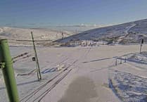
Easterly winds during the second week brought some rather cold days, with the temperature barely reaching 4°C on February 9.
Meanwhile February 20 was the warmest February day on record, with the temperature climbing to 13.2°C at Ronaldsway. The lowest minimum temperature during the month was 0.1°C, recorded on February 5.
Rainfall totalled 100.9mm, almost double the long term average.
The wettest day was February 3 with 30.5mm, leading to some localised flooding.
The average wind speed in the month was 15.4 knots (17.7mph) and there were two named storms - Doris on February 23 and Ewan on February 26.
Doris was the most significant, with gusts to 72mph recorded. Trees and power lines were brought down across the island.
Sunshine was only about half the long-term average at 49 hours. The best day was February 5 with seven hours.
There were four days with hail, three with sleet/snow and six with ground frost.
Met Office records date back to 1946.


.jpeg?width=209&height=140&crop=209:145,smart&quality=75)

Comments
This article has no comments yet. Be the first to leave a comment.