

The island is bracing itself for snowy and windy conditions today.
The mountain road is closed between Creg-ny-Baa and Ramsey Hairpin because of worsening weather conditions.
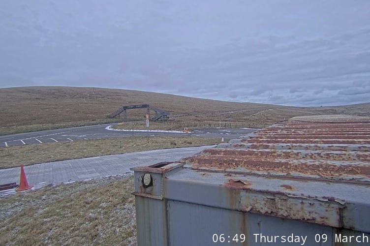
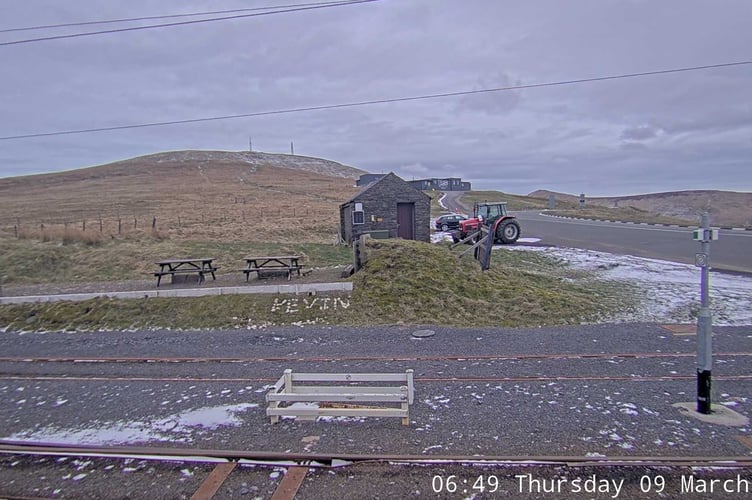
The government's webcams on Snaefell don't yet show big falls of snow.

.jpeg?width=209&height=140&crop=209:145,smart&quality=75)


An amber weather warning is in force from noon.
Snow is likely to become persistent across the island by this afternoon, often heavy, and continuing through the evening and into the early hours of Friday.
Significant moderate, perhaps locally heavy, accumulations of snow are possible at all levels and this will be accompanied by strong to near-gale force east to northeast winds leading to blizzards and drifting, especially but not exclusively on high ground and in the west of the island.
Cable icing could also be an issue for overhead conductors in some locations. There's a high risk of disruption to travel and, perhaps, for network services (power and communications).
In addition, coastal overtopping is expected at high tide at 12.30pm.Areas at risk include the whole of Douglas promenade, Laxey prom, Ramsey prom, Derbyhaven and to a lesser extent Castletown prom and Shore Road, Rushen (Gansey).
The detailed forecast from the Met Office at Ronaldsway Airport:
Dry and cloudy to start then an area of rain, sleet and snow arriving through the morning becoming widespread and persistent through this afternoon.
Falling as rain or sleet over lower levels and along the east coast. For higher ground risk of moderate locally heavy accumulations of snow. Strong to gale force east or northeast wind leading to blizzards and the blowing or drifting of snow over high ground and the west of the island.
Snow becoming heavier and more widespread through this evening and overnight with snow falling even down to low-levels as the wind backs north or northeast.
Outlook
The snow clears away quickly tomorrow morning with lengthy sunny spells developing and the small risk of isolated wintry showers and lighter winds. Temperature rising to 6°C by the afternoon with partial snow melt before refreezing in the evening and overnight into Saturday with widespread icy stretches.
Cold start to the day on Saturday with frost and icy stretches, otherwise dry and bright for much of the day ahead of a band of rain arriving later in the day that may initially fall as snow over the hills. Strengthening south or southeast wind and top temperature 7°C.
Sunrise: 6:49am
Sunset: 6:10pm
Comments
This article has no comments yet. Be the first to leave a comment.