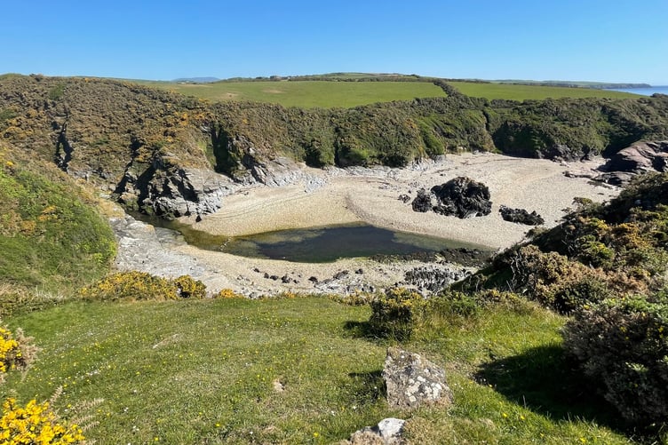
Santon Gorge is a curious place.
This beautiful part of the coast sees the greeny blue Santon Burn lazily meet the Irish Sea surrounding by layers of bedrock and gorse-filled fields.
Yet, this idyllic place is also just a short distance from Ronaldsway Airport and a working quarry.
If that contradiction was not enough to make this area quirk enough then why not throw in an ancient fort and some enigmatic carvings?
.jpeg?width=209&height=140&crop=209:145,smart&quality=75)

.jpeg?width=209&height=140&crop=209:145,smart&quality=75)
I’d read about the 13 crosses carved into rocks at the gorge and felt compelled to try and find them.
The origin of the crudely engraved crosses on a flat section of rock remains something of a mystery.
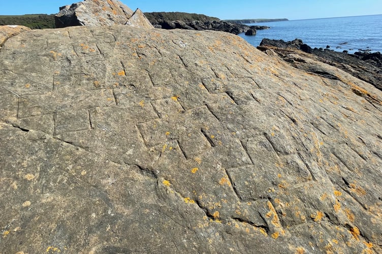
The most plausible theory is that they commemorate lives lost on the rocks following a shipwreck. That said, there are no records of such a wreck of this section of coastline.
In his book ‘Shipwrecks of the Isle of Man’ Adrian Corkill mentions the style of crosses carved on the rock are likely to be pre-1800 and that between 1644 and 1799 not all Manx wrecks were recorded.
To get there you could incorporate a longer walk but my mission was to see the crosses. While you only have to traverse a short distance, it is a tricky journey.
Firstly, you need to drive through the Balthane industrial estate at Ballasalla and carry on along the lane which takes you towards the quarry. Be careful as there are some large trucks.
I ended up driving right to the quarry entrance and parked up.
There is a path with a sign I was drawn to but that takes down to the river and along the path back over towards Port Grenagh.
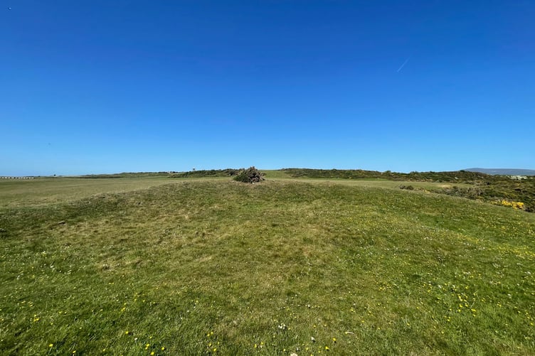
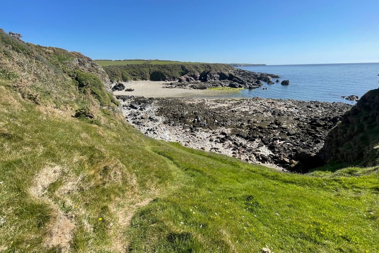
You need to cross the field – there are openings in the walls and fencing – which takes you to the Iron Age promontory fort at Cass ny Hawin.
There is not a huge amount to see but it is still a fascinating glimpse into our ancient history. The are the remains of an earth bank, creating a fort which would have been built 2,000 years ago. It was later used by the Vikings.
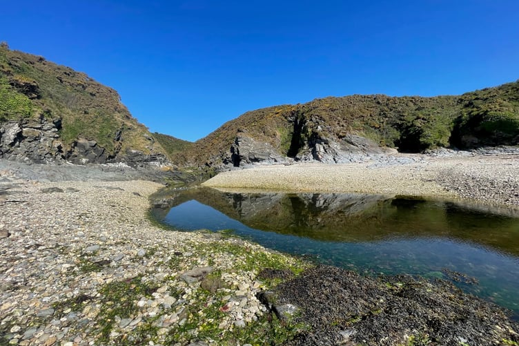
Once you have admired the fort, you will see a steep zigzag path taking you down to the gorge. You will need to tread carefully. It wet weather it will be muddy and slippery and in dry weather there are quite a lot of loose stones.
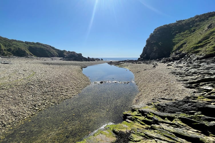
It is a bit of a clamber to reach the bottom. Once there, you then turn right where you will see some grassy rocks which you will need to climb up (only a few feet high).
After that you have to clamber down and then negotiate some tricky rocks across to more bedrock which you need to clamber up.
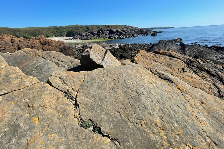
Here, you will see a flat surface and you need to scan closely to see the crosses. The carvings are not too deep so it can be a little tricky and are peppered with yellow lichen.
It is amazing to think these crosses were created up to 500 years ago and you wonder why here in such an inaccessible place. It was not easy but it is rewarding to find them and the view isn’t bad either.
You will need to ensure you go at low tide and its best in good weather.