
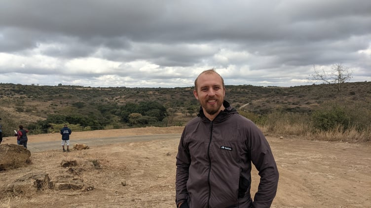
David Collins is an analyst developer for Mann GIS, the government’s digital mapping service, which many people don’t know exists despite it dating back to 1992.
A former Afghanistan veteran with background in the Royal Engineers, and more recently overseas charity aid work, David explained to the Examiner what a wide range of potential uses digital mapping could have.
For example, a recent high-profile demonstration of the utility of mapping data was providing a platform which allowed people to look up the location of their nearest public-use defibrillator in the island.
And most lately during the pandemic, an ‘Island Navigator’ map was introduced which allowed for the ‘rapid location’ of addresses in order to deliver goods and medical supplies by businesses and volunteers, particularly those helping the vulnerable.
.jpeg?width=209&height=140&crop=209:145,smart&quality=75)
-(3).jpeg?width=209&height=140&crop=209:145,smart&quality=75)
The public can already access the entirety of the map resources which David’s department have collated at: www.gov.im/maps/.
These provide mapping for a range of data, from school catchment areas, to wedding venues, to the location of every salt grit bin and when it was last emptied.
‘So if you came across one and it’s not full, you can phone them up and say “salt bin number so and so is empty”, and they know exactly what bin you are talking about,’ David said.
Even the way that the island’s modern buses make loudspeaker announcements as they approach certain stops is based on their GPS relying on data collected by his department – with the maps maintained by his team acting as a ‘centralised database’ for these different layers of date, including the island’s 946 bus stops.
David thinks that the government’s mapping capabilities could also be used in the island to collect information on even more things, such as dustbins or recycling bins.
With the proliferation of smartphones, it has made it possible for the public to widely contribute locations to such databases as well, he explained.
To highlight this, on the paper-based (pre-smartphone system) only 66 defibrillators were registered – but now within the last month more than 150 have been registered.
‘And that’s still a long way to go, because I know Craig’s Heartstrong Foundation installed more than 500 of these,’ David added.
He went on: ‘But on the back end of that, what the public don’t see, is that that [defibrillator map] is pulling information from Manx Utilities.’
‘In the same way that the Emergency Service Joint Control Room see the location of every single fire hydrant, they’re now seeing every electric substation.
‘All you have to do is look back to 2018 when there was a fire on [Douglas’s South] Quay, and there was an electric substation that they weren’t fully aware of – so [it’s now] having it visible on map.
David continued: So it’s putting everything in a combined area so everyone can see that.
‘You go back a few years and people used to talk about “the dream” – that when the Department of Infrastructure dig up a road, they’re also able to do the water, and the gas and all the other pipes – well that’s easier to do if you know where everything is’.
Another need which he identified from personal experience after his dad had a stroke, was if all the drop-kerbs on the island could be listed.
This would mean that disabled people would not have to go to such lengths to plan any journey based on whether or not they could find these kerbs.
David said: ‘There would have to be a conversation with disabled people – because the public are the best people to identify these shortfalls in data.
‘To me, from taking my dad around you can see that just calculating a route into town has been difficult – and once you get in, which shops and restaurants have accessibility and how do you access them?
‘If you go to the Villa, there’s a completely different access for disabled people – did I know that before my dad had a stroke? No, I needed to be made aware of it.’
With regards to waste and recycling bins, David said that data is held on these by all the separate local authorities rather than in one centralised place.
However, if the public were willing to collect and contribute the locations of bins in the same way they did for defibrillators, then ‘it would be a good starting point’.
This month, David took leave from his government job to put his skills to use (having qualified as a military geographic technician) to travel to Madagascar to help with the aid efforts there in the wake of a destructive cyclone.
He was working there, alongside United Nations personnel, with a charity he volunteers for – Map Action (mapaction.org), which specialises in providing mapping services for humanitarian disasters.
Talking about the island again, David said last month’s storm preparation highlighted the potential to ‘get real value’ from combining the collection of different types of data.
He explained: ‘The main cause of flooding in my street is because the gullies get covered over by leaves in autumn.
‘So when I’m out walking my dog I can push the leaves off them and then it solves the problem – but at the same time, if you knew where all the gullies were and where all the trees were, [the government] could send a roadsweeper around before all the major storms and make sure that’s not going to be a problem – so you can do a lot more proactive rather than reactive work if you know where these things are.’
On www.gov.im there is already a flood risk map, alongside other maps like ‘local information’ which lists doctors and pharmacies.
David said he would like to see more different types of data added, but that cannot be up to him – ultimately the public needs to show a demand for it, as was done with the defibrillators.
‘But to me I can see the value there, and the reason I can see the value is because of my previous work – in the military this was lifesaving stuff, [like] when you’re sending helicopters in to help people.’
‘And then if you take Madagascar, it becomes apparent how useful this information is when circumstances change,’ David said.
‘So the reason we were able to quickly map Covid in the island is because we already had systems in place.
‘But over there, because of the cyclone damage [to roads] what went from being a two-day motorbike ride was then an eight day walk.’
David concluded: ‘The first law of geography is everything is related – just closer things are more closely related.
‘So the stuff I did in Afghanistan had benefits to the Isle of Man government, and the stuff that I do for the government has benefits to Africa, [or even] the Ukraine.’
Comments
This article has no comments yet. Be the first to leave a comment.