


It’s going to be wet.
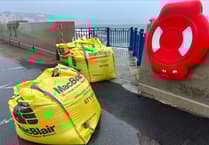
The Met Office has issued a yellow weather warning for coastal overtopping.
The forecast:
Persistent and often heavy rain will continue to affect the island this morning before gradually dying away this afternoon.
.jpeg?width=209&height=140&crop=209:145,smart&quality=75)


It will become windy once more as the fresh southeast wind quickly turns to the west or southwest and increases strong to gale force by midday with gusts of 40-50mph likely for a time.
This brings a risk of sea water and debris splashing over onto exposed coastal roads and promenades around the time of high tide (12:51pm). Maximum temperature around 9°C.
This evening & tonight will be mostly dry with just a slight risk of a shower. The strong west to northwest wind will gradually fall light to moderate with lowest temperature near to 3°C.
Tomorrow will be bright with sunny spells and a few scattered showers. The light westerly wind will veer to the northeast later in the day with highs of 6 or possibly 7°C.
Dry and bright on Saturday with lengthy sunny intervals.
Breezy though with a fresh to strong north-easterly wind, making it feel quite cold with temperatures only reaching up to 5 or 6°C at best.
The winds will gradually fall light overnight allowing a frost to develop.
Comments
This article has no comments yet. Be the first to leave a comment.