

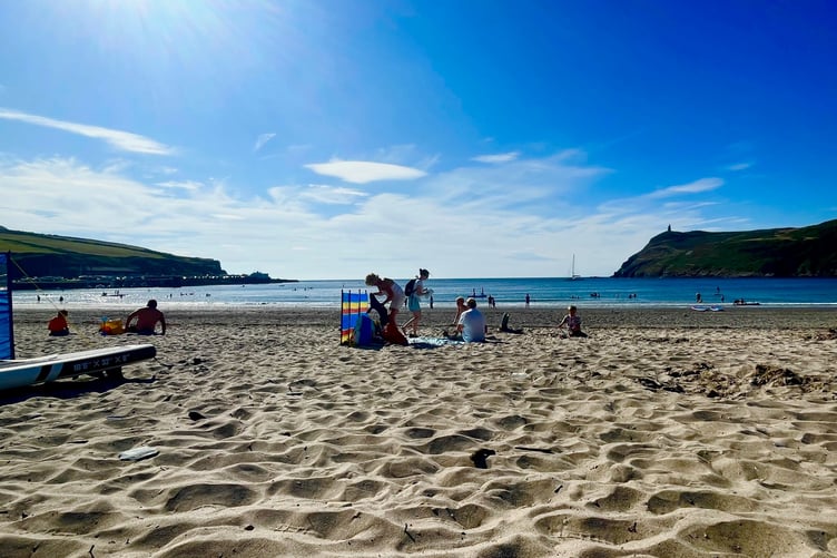
This August has turned out to be one of the driest and warmest on record.
The Isle of Man has enjoyed a number of very warm and sunny days throughout the month with a series of mini-heatwaves.
The average minimum temperature – standing at 14C – is the highest on record while it is the second warmest with an average of 16.9C which is just behind 1995’s average of 17.8C. The maximum average temperature stood at 19.8C.
The reason why it might not be the warmest on record is due to no periods of really hot weather with the highest, a very pleasant but hardly scorching, 24.6C recorded on August 12.


Gary Salisbury, of the Ronaldsway Met Office, said: ‘The fine summer weather continued into August, with the month turning out to be warmer and drier than the long-term 30-year average (1991-2020).
‘The mean of the daily maxima came to 19.8°C, which is 1.7C up on the 1991 to 2020 average, and 2.3C above the 1961-1990 30 year average.
‘Daily minima were also well above average, indeed the mean minimum of 14.0°C across the month is the highest on record, pipping the 13.9°C from 1995.’
August also proved one of the driest months on record.
Mr Salisbury said: ‘Rainfall came to just 23.3mm in the gauge, which is the driest since 2003. The driest August was 1976 with just 4.1mm of rain.
Sunshine came to 204.8 hours which is about 20 hours up on the long-term average. August 17 was the sunniest day, with 13.2 hours.’
Winds were light for much of the month, but some strong winds on August 4 and 31 meant the mean came to 10.7 knots which is about 0.8 knots above average.
The Met Office says it will soon release data for the whole summer but indicates it could well be the warmest on record.