
As an island community we depend on the sea for so much - but it is also easy to take it for granted. In a monthly column, Dr Lara Howe, marine officer with the Manx Wildlife Trust, and Dr Peter Duncan, senior marine environment officer at DEFA, explore this underwater world and the lives of some of those who work there.
The sea makes up around 87% of the territorial area of the Isle of Man, but naturally most of us spend the majority of our time living on, and thinking about the other 13%.
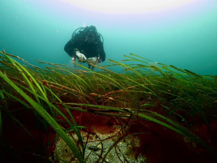
This highlights one of the biggest problems of working in the marine environment; that it’s a difficult and expensive place to work in, and collect information about, and is quite ‘alien’ to most of us, and therefore perhaps easy not to think about too much!
However, the management of marine protected species and habitats, marine nature reserves, fisheries, the responses of the sea to climate change, and even how the environmental impacts of marine developments, like windfarms or hydrocarbon exploitation, are determined all require a lot of basic information and ongoing monitoring and surveys.
-(4).jpeg?width=209&height=140&crop=209:145,smart&quality=75)


So where does this information come from, how and who collects it, and how is it used?
To start with the basics, the Manx territorial sea is about 4,000 square km(1,500 square miles), and extends to 12 nautical miles (22 km) from shore.
Manx seas are owned and managed by the Manx Government, mostly by the Department of Infrastructure (DoI) and the Department of Environment, Food and Agriculture (DEFA).
These departments have responsibilities and powers under legislation, which are outlined in the first chapter of the Manx Marine Environmental Assessment.
The whole report covers every imaginable topic related to Manx seas, and is a great place to find technical information about our waters.
The basic information about the territorial sea relates to things like depth, water movement (tides and currents), water characteristics (e.g. temperature, salinity) and seabed types (e.g. rock, sand, gravel) – and also how these vary over time (from daily to annually) and from place to place (e.g. east to west coast).
These are known as the physical and chemical (or physicochemical) characteristics, and many of these have been recorded and studied for decades, even centuries, because of their importance to navigation.
Measuring physical characteristics of the sea, particularly in relation to safe navigation is called hydrography, and the UK Royal Navy has historically been the main organisation responsible for this in Manx waters.
However, with the development of the UK Hydrographic Office, and the island being signatory to various international maritime agreements, these responsibilities now lie with the DoI, and outlined in the local civil hydrography programme (2021- 2031) which is available on the government website.
Broadly speaking, the territorial sea can be split in two; the shallower eastern Irish Sea, between the island and the UK, which is typically much less than 50m, and the deeper, western Irish Sea, between the Isle of Man and Ireland, which can be more than 100m deep.
The eastern Irish Sea is much more influenced by depth (cooling faster in winter and warming more quickly in summer) and by run-off from the UK, including fresh water, nutrients and pollutants.
By contrast, the western Irish Sea water is more stable, due to its Atlantic Ocean origins, and is typically cooler, lower in nutrients and of more constant salinity.
Sea temperatures have typically been measured by scientific researchers, and the Port Erin Marine Laboratory certainly played its part, maintaining a daily sea-surface temperature record since 1904.
Long time series, such as this, are invaluable to researchers, especially in monitoring climate change, and this monitoring station is actually included in the online US NOAA Marine Ecological Time Series Database.
Despite annual variations, the 100-plus years of monitoring do point towards higher water temperatures at Port Erin, increasing by around 0.7C over that period
As yet we do not know the long-term effects of such changes, but it is likely to affect biological systems, and more so if the trend continues. DEFA continues to monitor the marine environment with data now published online;
The monitoring of marine biological systems will be the feature of the next articles in this series.
Comments
This article has no comments yet. Be the first to leave a comment.