The Isle of Man Government has urged residents to prepare for severe weather as Storm Bram approaches, with the Met Office issuing a series of warnings including a rare red alert for coastal flooding.
The first of the warnings came into force at midnight on Tuesday, December 9, when Ronaldsway Met Office issued a ten-hour amber alert for heavy rain.
The warning is in place until 10am and covers persistent, intense rainfall expected to affect the island overnight and into Tuesday morning.
Forecasters have predicted that most areas could see between 20 and 30mm of rain within nine hours, with higher ground potentially receiving 30 to 45mm.
The heaviest period is expected between 3am and 6am, when up to 20mm could fall in just three hours, increasing the risk of standing water and disruption during the morning commute.
The Met Office has also highlighted that river levels are likely to respond quickly due to the already saturated ground, raising the potential for localised flooding.
Following the overnight rain, the island faces the arrival of Storm Bram, with the Met Office issuing a red warning for strong waves between 1pm and 4pm on Tuesday.
This alert, which coincides with the afternoon high tide at around 2.30pm, warns of south to south-southwesterly gales strengthening to severe gale force, which could combine with the high tide to cause major volumes of water and debris to overtop exposed coastal areas.
Locations expected to be worst affected include Castletown promenades, Shore Road in Rushen, and the northern end of Douglas Promenade. Ramsey and Laxey promenades may also experience overtopping, though at a lower severity, with impacts expected to fall within the yellow to amber range.
Alongside the red warning, a yellow alert for severe gales has been issued for the wider island, with winds expected to remain at gale force for much of the day.
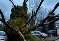
Authorities have warned that the combination of saturated ground and strong winds could lead to fallen trees, surface water, and disruptions to travel.
In addition, an inner harbour flooding advisory has been issued.
While forecast levels remain just below the yellow warning threshold, forecasters caution that the combination of strong winds, a large tidal surge, and high tide could still lead to minor flooding in inner harbours. Conditions will be reassessed following the peak tide.
In response to the warnings, the Department of Infrastructure has outlined sandbag collection points across the island to help residents protect their properties.
Sandbags are available in Laxey at the fire station, Shore Road Promenade, and the Recycle Centre on Glen Road; in Ramsey at Market Square car park, West Quay Christian Street, West Quay near the Trafalgar Hotel, and West Quay East Street; at Douglas Harbour on North Quay near Market Hill, North Quay Ridgeway Street, and Lake Road; on Douglas Promenade at Castle Mona Avenue, Spectrum Apartments, Millennium Court, and Strathallan Crescent; and in Castletown on Shore Road Promenade, Promenade Pickard Close, Hope Street Qualtrough’s Yard, Bank Street, and Bridge Street.
Deployment of sandbag stocks is ongoing and is expected to continue until early evening.
In addition, self-fill sandbags and sand are freely available at the island’s Civic Amenity Centres during normal working hours, including the Eastern Civic Amenity Site at Middle Park Industrial Estate, Braddan; Northern Civic Amenity Site at Bride Road, Lezayre; Southern Civic Amenity Site at Castletown Road, Port St Mary; and Western Civic Amenity Site at Curragh Road, St John’s.
Residents are urged to collect only what they need to ensure supplies remain available for others.
Elsewhere, the National Sports Centre (NSC) has already confirmed it will shut early at 8pm tonight (Monday) ahead of the rainfall, and Lloyds Bank has confirmed its Isle of Man branch will be closed for the entire day tomorrow (Tuesday).
Highway Services and the Isle of Man Met Office have reminded the public to follow official weather updates and take care during the forecast period of heavy rain, high winds, and potential coastal flooding.
.jpeg?width=752&height=500&crop=752:500)


-(1).jpeg?width=209&height=140&crop=209:145,smart&quality=75)
-(2).jpeg?width=209&height=140&crop=209:145,smart&quality=75)