.JPG?width=94&height=94&crop=1:1,smart&quality=75)

A fresh yellow weather warning has been issued for the whole Isle of Man, coming into force at 5pm today (Friday 14 November) and running until 3am on Saturday 15 November.


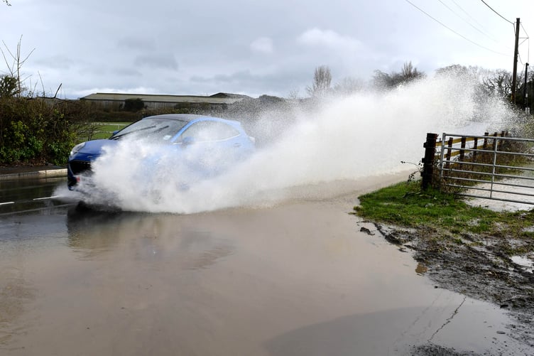
Forecasters say another band of rain will move up from the south on Friday evening, turning heavy at times. Widespread totals of 10 to 20mm are expected, with localised falls of up to 25 to 30mm. The Met Office at Ronaldsway warns this could lead to further surface water flooding in areas where the ground is already saturated or where drains are blocked.
Strong to gale force east-northeast winds are also forecast, with gusts of 45 to 55mph. These could cause minor damage in places and bring additional debris onto the roads from trees.
This is the third weather warning issued for the island this week. Earlier alerts for heavy rain were in place on Tuesday and again from Wednesday evening into Thursday morning.
Storm Claude, which is set to bring heavy rain and stronger winds to parts of England and Wales over the same period, is being monitored by UK forecasters. While it is not thought to be directly responsible for this latest warning for the Isle of Man, its wider weather system is contributing to unsettled conditions across the region.
Motorists are being urged to take extra care, particularly on rural routes where standing water and autumn debris may make conditions more difficult. Residents in low-lying or flood-prone areas are advised to stay alert to localised flooding, and anyone with loose outdoor items is encouraged to secure them ahead of the stronger gusts expected overnight.