
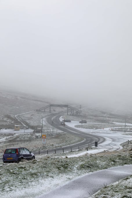
The Met Office has issued a yellow weather warning for ice from 8pm tonight until noon tomorrow:
The warning:
In any clear skies this evening and overnight temperatures may dip below ZERO leading to the risk of icy patches on untreated surfaces away from windward coasts.
Showers overnight falling mainly as rain but possibly as sleet above 1,200 feet

-(2).jpeg?width=209&height=140&crop=209:145,smart&quality=75)


During Sunday morning (from around 9am) there is a small risk that an area of precipitation may fall initially as sleet or snow above 1,000ft. This turning back to rain in the afternoon as temperatures rise.
The forecast:
Mainly dry with variable amounts of cloud and a few showers. Small risk of isolated icy patches developing in places sheltered from the moderate to fresh south or southeast wind. Minimum temperature 2°C.
Dry and largely cloudy to start tomorrow with a fresh to strong southeast wind. Rain arriving through the morning may fall as sleet or snow over the hills before turning back to rain in the afternoon. Southeast winds increasing strong to gale force later in the day, top temperature 8°C.
Sunrise: 8:33am Tomorrow Sunset: 3:56pm Tomorrow
Outlook
Often cloudy on Monday with occasional outbreaks of rain or drizzle. Much milder than of late with top temperature around 13°C.
Still windy though with a strong to gale force south-southwest wind.
Comments
This article has no comments yet. Be the first to leave a comment.