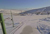
The Isle of Man is bracing itself for storm weather as gale to severe gale winds are forecast..
The A18 Mountain Road is closed between Ramsey (Barrule Park) to The Creg Na Baa due to high winds which are predicted to carry on for a number of hours. The emergency closure order will be in force until 10am tomorrow morning.Meanwhile, the government’s Department of the Environment, Food and Agriculture is telling people to be wary of the risks near trees and to avoid wooded areas, its forests and glens.
The first winds are due to arrive this afternoon and the second on Friday.
The DEFA’s forestry team sayd that the risks arise not just during the windy periods since trees may be uprooted or broken but balancing against other trees and could fall at any time later.
The team will try to inspect key areas on Monday.
The Steam Packet’s sailing tonight might be disrupted or cancelled. The company says it will decide by 5.30pm.
The Met Office has issued two weather warnings.
The first is a yellow warning for gales for today, from 4pm till 2pm.
Areas are likely to be affected
The strongest gusts on windward coasts and high ground.
The Met Office says:
Strong to gale force southwesterly winds veering to a gale force westerly later on Wednesday afternoon, and reaching severe gale force at times into the evening, gusts 60 to 65mph, giving the risk of some travel delays or disruption and possibly causing minor damage in places with the risk of trees or branches falling onto some roads and/or overhead conductors.
The gales abating overnight, becoming less windy during Thursday but strong to gale force winds returning overnight into Friday morning and then likely to increase to severe gale force for a while on Friday.
An amber warning is in place for FRIDAY between 11am and 4pm.
The Met Office says:
Strong winds increasing to reach severe gale to storm force for a while on Friday, mean speeds 45-50mph with gusts 60-70mph but up to 75mph in more exposed locations.
Travel disruption is expected and some falling trees and the risk of structural damage.
Also, a spell of heavy rain turning to sleet, then snow showers, with a covering of snow especially over high ground by the afternoon - drifting in the gales.
There’ll be coastal overtopping on Peel promenade late morning and early afternoon. High is at 12:26pm.
There’s still some uncertainty in the exact depth and track of Storm Eunice, so a detailed warning will be issued in due course.
This afternoon’s forecast from the Met Office:
Further outbreaks of rain, turning heavy at times, clearing to showers late afternoon as the strong southwest winds veer westerly and increase to reach gale or severe gale force for a time into this evening with gusts of 55-65 mph and the risk of some minor damage in places. Top temperature 12°C.
Bright spells and isolated wintry showers tomorrow. Strong westerly winds will gradually decrease, before heavy rain develops overnight as the winds increase strong to gale force again. Temperatures around 6°C
Rain on Friday morning, heavy at times, turning to snow over higher ground before clearing around lunchtime, followed by a few snow showers and sunny intervals. Severe gale northwest winds will develop, gradually backing westerly and decreasing slightly into the evening.
***
If you take any photos of storm damage, please let us know.
Email [email protected] with large Jpegs. Please say where and when the photos were taken.


.jpeg?width=209&height=140&crop=209:145,smart&quality=75)