
Cycling and walking routes within a 2.5-mile radius of Douglas are due to be better linked to accommodate pedestrians.
As 35% of the island’s population are based in the town, the government’s Active Travel Investment Plan looks to develop routes in the area to encourage people of all ages to walk and cycle to schools and work.
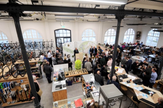
This was announced at an event held at Noa Bakehouse and Bikestyle in Douglas.
Following assessments by transport charity Sustrans, which took into account appropriate distances for everyday active travel, topography and knowledge from local people, the Department of Infrastructure established that missing links in the town are a must for safer routes.
.png?width=209&height=140&crop=209:145,smart&quality=75)

.jpeg?width=209&height=140&crop=209:145,smart&quality=75)
.jpeg?width=209&height=140&crop=209:145,smart&quality=75)
A toucan crossing near Quarterbridge is being designed to bridge the gap from the NSC and the old railway line.
’The designs are looking at how the traffic flow could be affected by the introduction.
’The idea is that we’d like to connect Douglas Promenade with Peel Promenade,’ said Tim Cowan, head of highway and asset management. ’
We have got an agreement to go through the NSC for this.’
The popular heritage trail is currently having tarmac put down near Crosby and St Johns to improve conditions for pedestrians and to make it wheelchair accessible.
A route in Onchan is being looked at.
Plans show it as a delineated surface for cyclists and walkers, which will begin on Governor’s Road to Glencrutchery Road, through Noble’s Park to Woodbourne Road into the town.
Infrastructure Minister, Ray Harmer, told the Examiner: ’It’s a really exciting initiative which is getting everybody together from health, education, police. It’s not just a Department of Infrastructure project and it couldn’t be because it wouldn’t work like that.
’We will need to work with Douglas Council to provide these routes. Issues like narrower streets can be overcome and we’re looking at simple initiatives.
’For instance, on the North Quay having people cycle in the opposite way to traffic.’
When asked if he actively travels himself, the Peel MHK replied: ’I cycle or walk to work.
It’s small journeys from Tynwald to the Sea Terminal. It’s taking out the one mile instead of thinking "well, I’ll get in the car".’
Kate Lord-Brennan MLC, member with responsibility for Highway Services, said: ’There has been consideration for businesses, schools and cycle storage.
’A pedestrian survey has been done and looked at areas around homes and schools.
’We’ve seen in places, like the Netherlands, people demanding safer paths for cyclists and safer streets for kids. We’re quite happy to have that demand here. This plan is something long term and it is the start.
’We’re not expecting people to do this everyday for every journey, but to select a couple of days. The more people there are out walking and cycling, the safer roads become.’
She added that she or her husband walk their child to school.
The plans are available to view at the Sea Terminal until Friday (May 17).
Comments
This article has no comments yet. Be the first to leave a comment.