
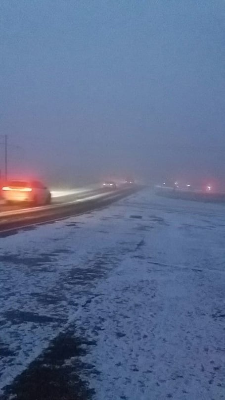
A yellow weather warning for ice and wintry showers is currently in force for the Isle of Man.
It lasts from 6pm tonight to 3pm tomorrow.
As cold air arrives from the north this evening and tonight, road surface temperatures are expected to below freezing widely across the island.
This brings a risk of ice forming on untreated surfaces which remain damp or wet from earlier rain or showers.


Temperatures at lower levels will gradually recover tomorrow morning, but for higher ground road surfaces are likely to remain close to freezing throughout the day with a continuing risk of ice.
There is also a risk of isolated wintry showers tonight, which, if they occur will fall as snow or hail at any level, but are unlikely to cause significant issues.
The forecast from the Met Office at the Ronaldsway Airport:
A risk of isolated wintry showers this evening & tonight, and rather cloudy until some clear spells develop later in the night. The moderate to fresh northwest wind will turn to the north and fall light, allowing temperatures to fall as low as -2°C, giving a risk of ice.
Outlook
Tomorrow will be cold but with lengthy sunny spells and only a small risk of a passing wintry shower. A light to moderate north to north-westerly breeze with temperatures only reaching up to 4 or 5°C at best.
Staying largely dry and bright on Wednesday with some hazy sunshine. Top temperature around 4°C, and feeling colder in the freshening easterly wind.
Comments
This article has no comments yet. Be the first to leave a comment.