
A new yellow weather warning for coastal overtopping is in force today (Wednesday) as waves continue to pose a risk along exposed sections of the island’s coastline.
The warning, issued by Ronaldsway Met Office, covers all exposed coasts and runs from 1.30am until 5pm on Wednesday, December 10.
Although conditions have eased since the height of Storm Bram on Tuesday, forecasters say some wave overtopping is still likely around the next two high tides, with a weather warning in place overnight for the 3am high tide, and 3.20pm, particularly at locations facing south or south-west.
‘Although winds will be lighter and waves smaller than during Storm Bram, there will still be some splash-over of waves at various coastal locations,’ the Met Office said, adding that further debris may be left at sites such as Shore Road and the north end of Douglas Promenade.


This latest alert was issued by duty forecaster Colin Gartshore.
The new warning follows a day of severe disruption on Tuesday, when Storm Bram brought storm-force winds, prompting a rare red alert for coastal overtopping.
Steam Packet sailings were cancelled, flights were axed at Ronaldsway, and emergency crews were called to dozens of incidents involving fallen trees, flooding and debris across the island.
You can read our live blog from the day back to see how it unfolded HERE.
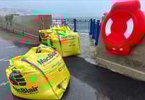
Cleanup operations continued into this morning, with Highway Services and supporting teams working to clear blocked routes and make coastal areas safe.
Plenty of roads remain shut today, you can find out where and for how long HERE.
Residents are advised to take care when travelling near the shoreline and to allow extra time for any potential delays caused by debris or standing water.