
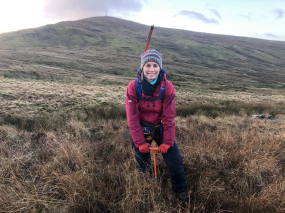
Getting out into the fresh mountain air, reporter Jess Ward talks to Sarah Hickey - a mires and volunteering officer with the Manx Wildlife Trust (MWT) who is carrying out a year-long project of mapping out peatland in the island’s uplands. The project is a big step in figuring out how best to restore the carbon-capturing wetlands.
Looking across the plains of Snaefell and its neighbouring hills, you’d be fooled in thinking that the land was pretty untouched and close to its natural state.
You could also wrongly believe that the habitat shares nothing particularly interesting. However, if you delve a little closer among the bio-rich landscape you’ll find decayed organic matter that is causing a global stir.
Peat was once common in fireplaces across the island.
.jpg?width=209&height=140&crop=209:145,smart&quality=75)


Now the focus has shifted from it being ’used’ to it being ’restored’.
That’s because undamaged peat captures carbon dioxide (CO2) emissions, provides safe drinking water and - something that’s particularly relevant to Laxey right now - it minimises flooding risks, Sarah tells me.
The problem is that past human activity in the island of chopping up peat and etching drains into the land, mixed with present road maintenance and other modern activities, has threatened the valuable ecosystem.
It’s an ecosystem that Sarah is keen to help bring back alongside government bodies, charities and volunteers.
’Peatlands can hold more carbon than forests,’ she said.
’Unlike trees, which can fall and decompose letting a lot of the carbon it captured back into the atmosphere again, peat acts as long-term storage.
’At the moment the peatlands here are probably emitting more carbon than capturing it because it’s eroding and when it’s dry it releases carbon.’
Sarah started researching the peatlands around the island as a MWT volunteer from 2017 before deciding to set up the project.
’I spoke with the Department of Environment, Food and Agriculture and they said it was something they wanted to do, but didn’t have anyone to do it,’ she said.
Securing funding from the Manx Lottery Trust, she started the project in September last year with the MWT, which set up the Manx Mires Partnership.
Roughly three times a week Sarah is out collecting data on the wetlands.
For this, she is armed with a GPS, a map, pen and notepad, peat probes and weather-sensible gear.
At every 150-metre point marked out on her map, she gathers an average depth of the turf and records it down.
The manual job is a soggy one and demands quite a bit of physical exertion when walking up or downhill, jumping over streams and driving the peat probe into the ground which is sometimes laden with rocks underneath.
She shows me the measurements of peat. Anything below 40cm is shallow, the mid-range measures at 40cm to 100cm. Anything above that is considered deep peat.
’In Scotland they’ve measured peat as deep as 10 metres,’ she said.
’They reckon in good conditions that half or 1mm of peat equals one year of growth.’
On our run, most of the peat hits the mid-range, which she says can be as old as 3,000 to 6,000 years old.
The most vulnerable area she’s recorded is Beinn-y-Phott, about 2km south west of Snaefell, which has been damaged by turf cutting.
In the recent past, people got licences to cut peat from the hillsides to burn in their homes.
Sarah points out mounds that have been cut into and therefore have left peat exposed to the elements. The exposed masses are called ’hags’.
The way this specific problem is being fixed in the UK and Ireland is by giving the hags a ’face lift’.
To do this, conservationists use a special digger to reduce the slope of the eroded land mass so that way it is sheltered again.
As well as being covered, peat needs wet conditions to help decompose vegetation.
Sarah also makes a note on whether any Sphagnum moss species, which act as a sponge by holding up to 20 times its dry mass in water, are within the 150m area as it shows a bog is actively growing peat.
One problem affecting the idyllic water levels is historical man-made drainage.
Sarah said: ’In the past they thought digging drains to dry out the peatlands would be better for grazing.’
She has written a report on this and has also contacted the Green Lane User Group about damage done today in terms of motoring.
’It’s about raising awareness,’ she said. ’If you’re going off the tracks you need to know that some of these places are particularly vulnerable.
’Peat restoration is not without its controversies as you’ve got to think about others using the area, like farming for example.’
With the survey being done, she added that the next step is to secure funding to create the restoration plan for suitable areas. Work would include blocking drainage channels to re-wet the peat and re-profiling peat hags.
’Blanket bog has been recognised as an internationally important habitat so we should be doing all we can to protect what we have on the island,’ she said.
For those looking to help Sarah by volunteering, contact her on [email protected]
Comments
This article has no comments yet. Be the first to leave a comment.